Jackson County Oregon
Cemeteries, Genealogy, Family History, Cemeteries
 |
Jackson County Oregon |
|
Jackson County Oregon |
This is a list of cemeteries in Jackson County, with addresses, phone numbers, hours of operation, directions, if necessary, and any other relevant information. If you know of a cemetery in Jackson County, please send an email with all the above information and I will list it here.
Antelope Cemetery
This cemetery is located on Riley Rd in Eagle Point.
On Hwy 62, travel north of White City. About 2.5 miles from the Antelope
Road intersection, at the stop light, take a right on Shasta Ave. Take
a right on Alta Vista Rd. Two miles down, Alta Vista makes a "T" with Riley
Rd. Take a right on Riley. The cemetery is .4 of a mile on the left, just
past house #1290. Contributed by Saira Ehlers
Antioch Cemetery
Contact Sexton, Art Coolidge at 541 840-9299 or email Judi Boyd 541 830-4825 . Directions:
3/4 mile north on Antioch Rd from Hwy 234. Open 24 hours. Oldest grave is 1857.
Index
Ashland Cemetery Index by Donald Wilson:
Cemetery pic
Located on the south side of East Main St., in
Ashland, between N. Morton St and N. Sherman St.
Index
Church of the Brethren aka Talent
aka Dunkard Cemetery (1888) Index by Donald Wilson
See Dunkard Cemetery below
Butte Falls Cemetery
Obenchain Rd. about .5 miles from Butte Falls Hwy.
Directions: From Hwy 62 turn onto Butte Falls Hwy and travel 13.6 miles
to Obenchain Road. Turn right onto Obenchain Road and go about 1/2 mile.
Cemetery is on the left. Gate is not locked.
Caroline Johnson Cemetery
Located along Hwy. 62 (Crater Lake Hwy) inside
the city limits of Shady Cove, Oregon. Coming from Medford, follow Crater
Lake Hwy (Hwy. 62) east to Shady Cove. Caroline Johnson Cemetery is on
left side of the road just before the bridge crossing the Rogue River.
The cemetery sits directly alongside the highway. It is near Aunt Caroline's
Park & Visitor Information Center located at Hwy 62 & Indian Creek
Road, Shady Cove.
Central Point I.O.O.F. Cemetery
This cemetery is located on Hamrick Road in Central
Point. From I-5, take the Central Point exit, #33. Take E. Pine St. east,
towards the Medford airport. Take a left on Hamrick Rd. The cemetery will
be .5 mile down, on the right. Pic contributed by Saira Ehlers
Index
Dunkard
Cemetery aka Church of the Brethren aka Talent (1888) Index by Donald Wilson:
Cemetery pic
Located on Highway 99 in Talent. This one is a
little tricky to find. From Talent, take Highway 99 north. The cemetery
is on the left, but there's no sign and you can't see it from the road.
Go .2 of a mile past the Colver Rd - Highway 99 intersection. Turn left
at the driveway to #5800. It is some sort of business. There is no sign.
Stay to the right and go straight on the little dirt road. The cemetery
will be on the left. If you go past the electrical sub-station, you have
gone too far. It is right across from the new Talent fire department building.
Contributed by Saira Ehlers
Eagle
Point National Cemetery
This is one of three national cemeteries in Oregon and is located on
Riley Rd in Eagle Point. On Highway 62, travel north of White City. About
2.5 miles from the Antelope Rd intersection, at the stop light, take a
right on Shasta Ave. Take a right on Alta Vista Rd. Two miles down, Alta
Vista makes a "T" with Riley Rd. Take a left on Riley. The cemetery is
one mile on the right. contributed by Saira Ehlers
Griffiin Cemetery
Sign on gate read "OLD GRIFFIN CR CEMETERY" occupies
a portion of Joseph Franklin Griffin's Oregon Donation Land Claim.
It is accessed through private property. From South Stage Road in
Medford, go south on Griffin Creek Road about 1.7 miles to Burrell Rd.
on your right. Go about .2 mile up the road to the private property
gate on the right. The owner is very accommodating to visitors, but
be sure and respect his land as you travel through to the cemetery at the
end of his driveway.
Index Hargadine Cemetery Index by Donald Wilson In Ashland, turn off of North Main St (also known as Hwy 99) west onto Sheridan St. Continue westbound until past Walnut St on the left and Monte Vista Dr on the right. The cemetery appears to be north west of this intersection.
This cemetery can be accessed by turning onto Hodson Rd. from Hwy 99, on the west side of I-5, a few miles outside of Gold Hill. It appears that it is located on private property and is not currently being tended, nor is there a contact.
Hill Dunn Cemetery (1853) and possible aka Issaac Hill Cemetery, see belowpicTravel east from Ashland on Hwy 66 toward Emigrant Lake. Turn left onto Emigrant Dam Access Rd. It appears that the cemetery may lay on the lake side of the road as you're traveling north on Emigrant Dam Access Rd.
Hill
Cemetery information written by Mrs. A. H. Russell February 1922 (in
her 80's according to family member)
Another set of directions - From Ashland,
take Highway 66 east and go past the Emigrant Lake entrance. Take the next
dirt road to the left. There is a "Day Use Only" sign and a "Lake Access"
sign as well. Also, there is a stop sign on the dirt road when you are
facing the highway. Contributed by Saira Ehlers
Hillcrest Mortuary and Memorial Park
North Phoenix Rd near Barnett Rd, Medford, OR 97501,
541-773-6162.
I.O.O.F. Ashland Cemetery
This cemetery is located on Normal St across the
street from Mountain View Cemetery.
I.O.O.F.
Eastwood Cemetery
Siskiyou Blvd just west of Highland Dr. Gate locked at 3:30P. City
of Medford Parks and Recreation, 200 S. Ivy. St., Room 400, Medford, OR;
541-774-2400 has list of burials and plot map. The mausoleum is kept locked
but a key can be checked out by contacting the Parks and Recreation office.
Another set of Directions - From Barnett Rd, turn onto Highland Dr.
At Siskiyou Blvd, turn left. The entry to the cemetery is a quick right,
behind the little stores. Contributed by Saira Ehlers
Index
Isaac Hill Cemetery Index by Donald Wilson
From the Ashland South I-5 freeway interchange, take Highway 66 East
approximately 3.9 miles. Take the fifth road to the left past the Emigrant
Lake entrance. The dirt road is elevated quite a bit above the surrounding
fields. There is a "Day Use Only" sign and a "Lake Access" sign at the
entrance to the fifth road. Also, there is a stop sign facing the highway.
Directions contributed by Donald Wilson
Jacksonville Pioneer Cemetery
In Jacksonville, from Hwy 238, turn north onto Oregon St and then west on E St.
Logtown Cemetery
5931 Highway 238, Jacksonville,
OR. From Jacksonville, take Highway 238 north going towards Grants Pass.
The cemetery is about 5.5 miles from downtown Jacksonville on the left.
Contributed by Saira Ehlers
Memory Gardens Mortuary and Memorial Park
1395 Arnold Ln., Medford, OR; 541-773-7338. Contributed
by Saira Ehlers
Meyers Cemetery
The private property owner requests ONLY FOOT TRAFFIC
TO THE CEMETERY.
DOES NOT require that he be notified prior to entering
the cemetery./p
Located on Ashland Lane, approximately .1 mile from
the intersection at Valley View Road. The cemetery is fenced on all four
sides, and is located within private property. The encircling property
is located at 183 Ashland Lane. Access to the private property is on the
left side of the lane. There is no cemetery sign along the lane. The cemetery
is situated at the top of the hill. Once inside the private property fence
entrance, follow the road to the left that heads up-hill. The road makes
a semi-circle of the property, passing in-front of the cemetery gate.
Contributed by Donald Wilson
Miller Family plot:
Update by Jeff Scism 09/2007
Directions: southeast on Antelope Road to milepost
16 then 1/10th of a mile, Left. 12255 Antelope Rd. Residents were Gordon
and Dorothy Park. Entry is by a dirt road; right fork goes to the residence,
left to the gravesite and homestead foundations. The distance is about
3/4 mile from gate, on a knoll. The graves are after a second gate, about
30 yards downslope towards Antelope Rd. Three sets of double graves with
headstones on three. Upslope graves are Abraham Miller, Jr., and Elizabeth
Turnidge Miller with no headstones, but a small metal marker "Abraham Miller".
Contributed by Jeff Scism.
Missouri Flats Cemetery
From Grants Pass, take Highway 238 south. Near
Murphy, take a left on North Applegate Road. Go about 7.5 miles and the
cemetery will be on the right. You will pass into Jackson County just before
the cemetery. Contributed by Saira Ehlers
Morse Family Plot
From I-5, take the Talent exit, #21. Go east on
Valley View Dr. Go two miles and turn left on Staple Dr. Go 1/10th of a
mile and the plot is on the right in a field near a tree. Contributed by Saira Ehlers
Mountain View Cemetery
440 Normal, Ashland, OR 97520, 541-482-3826. Office
on site has list of burials and plot map.
Index Myer Cemetery Index by Donald Wilson
Myer Cemetery is located
on Ashland Lane, approximately 1 tenth of a mile from the intersection
at Valley View Road. The cemetery is fenced on all four sides, and is located
within private property. The encircling property is located at 183 Ashland
Lane. Access to the private property is on the left side of the lane. There
is no cemetery sign along the lane or at the cemetery. The cemetery is
situated at the top of the hill. Once inside the private property fence
entrance, follow the road to the left that heads up-hill. The road makes
a semi-circle of the property, passing in-front of the cemetery gate. The
private property owner did not require that he be notified prior to entering
the cemetery, but does only want foot traffic to the cemetery. (directions
contributed by Donald Wilson
Pankey Cemetery
This cemetery is located on Ramsey Rd, near Gold
Hill. Directions: Hwy 234 to Old Sams Valley Road to Ramsey Road. On the
right just after 8675 Ramsey Road. Open on Sundays (probably the rest of
the week also).
Another set of Directions: From I-5, take the Gold
Hill exit, #40. Follow the signs to Hwy 99. Take a left on Hwy 99, going
into Gold Hill. Take a right on Hwy 234 (aka Sams Valley Hwy). Follow it
until you get to Ramsey Rd. Take a left on Ramsey. The cemetery will be
1.5 mile down on the right, just past house #8675. (Note: the road splits
into a "Y" one mile down and Ramsey veers off to the left. It's easy to
miss if you are going too fast.) Contributed by Saira Ehlers
Phoenix Pioneer Cemetery
In the town of Phoenix, turn west off Hwy 99 onto
4th St. Go to Church St. and turn North. The cemetery is on the left.
Rock Point I.O.O.F. Cemetery
This cemetery is located north of Gold Hill on
Highway 99. From I-5, take Exit 43, north of Gold Hill. Follow the signs
to Highway 99. Turn right on Highway 99, going towards Gold Hill. Go over
the Rogue River and on the straight-away, the cemetery will be on the left.
There is a sign on the right pointing to the dirt road that enters the
cemetery. The sign on the front gate states the hours as 10 a.m. - 7 p.m.
The phone number is 541-855-1559. Contributed by Saira Ehlers
Rock Point Pioneer Cemetery
This cemetery is located north of Gold Hill on
Highway 99. From I-5, take Exit 43, north of Gold Hill. Follow the signs
to Highway 99. Turn right on Highway 99, going towards Gold Hill. Go over
the Rogue River and on the straight-away, the cemetery will be on the left.
There is a sign on the right pointing to the dirt road that enters the
cemetery. The sign on the front gate states the hours as 10 a.m. - 7 p.m.
The phone number is 541-855-1559. Contributed by Saira Ehlers
Scenic Hills Memorial Park (1964)
2585 E Hills Dr., Ashand, OR 97520, 541-482-4444.
Office is at Litwiller-Simonsen Funeral Home, 1811 Ashland St., Ashland,
OR 97520, 541-482-2816.
Another set of Directions - Located on East Main
St., Ashland. From Tolman Creek Rd, go toward East Main St. Turn right
on East Main. Go .2 of a mile over the freeway. There is a sign on the
right pointing to the dirt road on the left. There is also a sign for the
Ashland Vineyard Tasting Room. Go straight on the dirt road, over the creek.
The cemetery is on the left. Contributed by Saira Ehlers
Siskiyou Memorial Park
2100 Siskiyou Blvd., Medford, OR 97501, 541-772-4013.
Stearns Cemetery
From Talent, OR follow Wagner Creek Rd. to Anderson
Rd. Turn onto Anderson Rd. and follow for .15 mile. The cemetery is on
the left.
Another set of directions - From Highway 99, turn onto Rapp Road. Go over the train tracks and at the stop sign, go straight. You are now on Wagner Creek Rd. Stay on Wagner Creek until you come to Anderson Creek Rd. Turn right. The cemetery is on the left, just past Allen Lane. Contributed by Saira Ehlers
Sterling Cemetery
This cemetery is located on Sterling road, 8 miles
from its junction with the
Applegate Road.
NOTES:Some 100 more are supposed to be buried in
this cemetery - locations
and names not marked at this time. This cemetery
information compiled by Mrs.
Marie Hogle. This information was read by Helen
& Harley Haskins and Esther & Mike Williams, August 23, 1969. Complete
dates from the Oregon Death Index were included for added information.
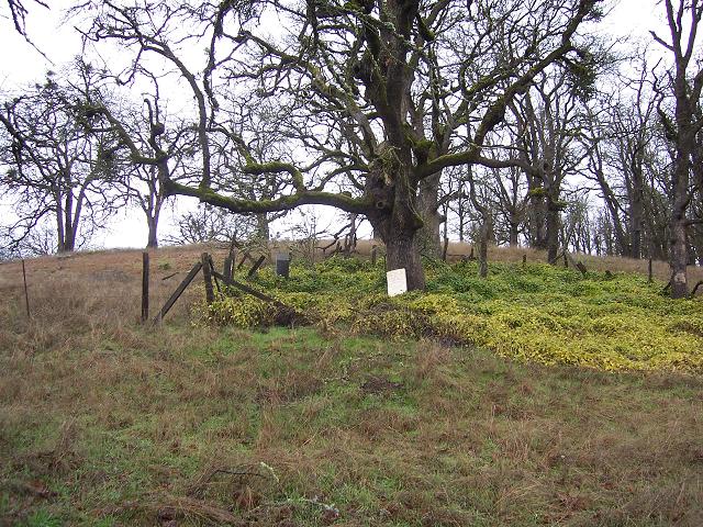
Squir Miller Cemetery Index by Donald Wilson
Cemetery Pic
From Highway 140 turn onto Meridian Road (Be sure
to turn at the Brownsboro sign). Turn at the first road to the right (Un-Named).
Turn at the first road to the left (Un-Named). Approximately 250 feet up
this road, on the right side, the cemetery can be seen on the side of the
hill. There is a large Oak tree in the middle. (This cemetery and directions
were found and contributed by Donald Wilson)
Index
Talent aka Dunkard Cemetery aka
Church of the Brethren (1888) Index by Donald Wilson
See Dunkard Cemetery above
Wells Family Cemetery
This cemetery is located on the corner of Hwy 66
and Crowson Rd in Ashland (on the 4th green at Oak Knoll Golf Course).
From I-5, take exit 14. Go east on Ashland St. (away from town and towards
the Windmill Ashland Hills Inn). Go 1.1 miles. Go past the Oak Knoll entrance
and take a right on Crowson Rd. The graves are on the right surrounded
by an grey iron fence. Contributed by Saira Ehlers
Woodville Cemetery
This cemetery is located in Wards Creek Rd, Rogue
River. From I-5, take exit 48. Turn onto Depot St and go towards town.
Do not go over the river. Cross the railroad tracks and turn right on Main
St. Take a left on Wards Creek Road. The cemetery is about .2 of a mile
on the left. It is closed at dusk. Contributed by Saira Ehlers
A link to cemeteries in Jackson and Josephine counties, some mentioned above and others can be found here